Deleted
Deleted Member
Posts: 0
|
GPS
Feb 25, 2011 13:08:19 GMT -5
Post by Deleted on Feb 25, 2011 13:08:19 GMT -5
|
|
|
|
GPS
Feb 25, 2011 15:27:41 GMT -5
Post by xsyamahadg on Feb 25, 2011 15:27:41 GMT -5
Get yourself a good map. I think my Garmin is worthless....but that might just be me.
|
|
|
|
GPS
Feb 26, 2011 9:00:53 GMT -5
Post by 87fxlr on Feb 26, 2011 9:00:53 GMT -5
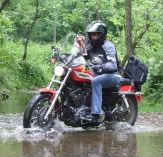
I have a garmin unit that has come in handy a time or two. However, you have to keep the maps updated yearly ($$$$). We used it for a trip to Weston, WV last year and it took us on some god awful route. I swear I heard banjo music  . My son lives near Houston, TX and his street dosen't show up at all. It does have the option of putting what it calls waypoints in that you could review later. It is motorcycle friendly (water resistant). My phone has google maps installed and does in my opinion a much better job in giving directions. It updates the itself every so often. I'm not sure if there is an option for recording a route or not. I haven't found the need personally. I also wouldn't want to leave it exposed to the elements either. It really depends on what your looking for I guess. Both have their advantages and disadvantages. |
|
Deleted
Deleted Member
Posts: 0
|
GPS
Feb 26, 2011 10:12:21 GMT -5
Post by Deleted on Feb 26, 2011 10:12:21 GMT -5
x87, the idea of using the phone is a good one. My phone has this feature too and I was going to try it before buying anything else. I'm just wondering if it uses signals from cell towers and not the GPS satellites. Most places I ride there is no cell signal.  |
|
|
|
GPS
Feb 26, 2011 10:38:08 GMT -5
Post by vstrom2up on Feb 26, 2011 10:38:08 GMT -5
We've navigated using a Garmen for years. From local riding to the trip out west. It is a great navigation aide, but we always say, it's just that: an aide. Nothing beats a good old fashion up-dated map from AAA when traveling. It never loses a signal and I've never had to argue with it about a detour when it is yelling at me to turn around. Even with updates, a GPS often shows a road that runs between my neighborhood and the adjacent one that was planned when the neighborhood was developed back in the 60's, but the road was never built. I have never seen a map with that road on though!
I recommend the Garmen brand. They seem to be the best for reception out in the boonies. But don't forget your map!!!
|
|
Deleted
Deleted Member
Posts: 0
|
GPS
Feb 26, 2011 12:45:53 GMT -5
Post by Deleted on Feb 26, 2011 12:45:53 GMT -5
Others have recommended Garmin also. I don't really care or need a system that will show me where to go. What I want is a system that will track me wherever I go and let me map it out after I get home. A lot of times I will see something while out riding and want to tell someone else where it is, and I can't because I've no idea where I was at the time. I just randomly ride!  I'm sure whatever system will have to be based on satellite reception because the cell signal is just not good enough in rural areas. Thanks for any help or suggestions. Dave |
|
|
|
GPS
Feb 26, 2011 17:44:46 GMT -5
Post by amtrak on Feb 26, 2011 17:44:46 GMT -5
|
|
|
|
GPS
Feb 26, 2011 18:55:04 GMT -5
Post by 87fxlr on Feb 26, 2011 18:55:04 GMT -5
Dave, My phone uses satellite signals for the google maps. Not sure what your phone is, but mine is android based. I believe that iphone uses a sat. signal as well. For what you are wanting to use the nav. system for, I would recommend a garmin unit. Mine does track my path and with the waypoint feature, I believe that is exactly what your after.
|
|
|
|
GPS
Feb 26, 2011 20:04:55 GMT -5
Post by x90rider on Feb 26, 2011 20:04:55 GMT -5
Dave, look for a GPS that has a chartplotter function. I have a 276C on my snowmobile and it records my entire ride. I am able to download it later and then print maps of my adventures. buy.garmin.com/shop/shop.do?pID=233&ra=true |
|
|
|
GPS
Apr 28, 2011 7:41:31 GMT -5
Post by mgorman on Apr 28, 2011 7:41:31 GMT -5
The cheaper the unit the less you can do with it.
Mine will let me plan routes then upload them to the unit from my pc based mapsourse program that comes with it. I can choose many different levels of travel from keep it safe on state routes to live and in person roadside banjo music and both will also let me navigate of-road to a point in the middle of no-where. It can be set to shortest distance, no u-turns, avoid tolls, avoid highways, etc.
My parents unit from Garmin has life time maps, uploadbale 4 times a year for life of the unit for $75
My units will also let me hit way points along the way and download my tracks and waypoints to my pc for use in Map Sourse or upload to google earth so I can see aerial photos of where I was.
As far as cell phone based mapping goes, be careful, the less towers around you the less accurate to a point you will not get anything. Last summer a freind had a small crash down in the hocking hills area and was going to head home early. We had to escort him back to an area with cell towers because his cell phone had zero reception.
Mine also got me through Pittburgh (the rats maze) over the mountains through West Virginia and to a remote home in the Ohio foothills and never missed a beat, never had to stop and look at a map and never made a bad turn. It's all in how you set them up and as mentioned before, how cheap you are or can afford.
And yes, they are only as accurate as the data given to them by the counties and states you drive through so there are some roads on there that are dedicated and not built and some that are built and not maintained (usually in the Banjo Districts)
|
|
|
|
GPS
Apr 28, 2011 17:02:07 GMT -5
Post by gearman on Apr 28, 2011 17:02:07 GMT -5
On the bike I use mine mainly for reference. Most roadmaps don't have nearly the detail the gps maps have. As far as recording a route, I wouldn't be surprised if most of the newer units will do that. Mine is a 3+ year old cheapy and it records but there's no way to download it. A Garmin is on my wishlist. The Spot is neat but it is $99/yr for the basic service and an additional $50 for the tracking feature. In my case, my wife thinks it's worth every penny for the peace of mind. I can check in when there's no phone service (it sends an email and a text message to her phone) and she can see my whereabouts (10 min intervals) online. Hey, if it makes her happy then I'm happy.
|
|
|
|
GPS
Apr 28, 2011 17:08:18 GMT -5
Post by gearman on Apr 28, 2011 17:08:18 GMT -5
Almost forgot the cited link. It sounds like the present gps receivers will either have to be updated or scrapped all together...and I can guarantee that 4G will win the battle. Have we out-technologied ourselves?
|
|
|
|
GPS
Apr 28, 2011 19:04:42 GMT -5
Post by jeffe on Apr 28, 2011 19:04:42 GMT -5
x87, the idea of using the phone is a good one. My phone has this feature too and I was going to try it before buying anything else. I'm just wondering if it uses signals from cell towers and not the GPS satellites. Most places I ride there is no cell signal. All the different cell phones I've used got their GPS signal from satellites but all the routing info etc did not come from the phone but from a central site and you need Internet on your phone.. You still need a cell signal. That being said if your is capable the Bing maps and directions is the best. I down loaded to my phone and it much better than the Sprint navigation already on the phone. I've had my Garmin for 2 years and love it. It has the traffic avoidance feature and has re routed my several times. Just yesterday it saved my over an hour of being stuck in major traffic caused by a wreck going into Pittsburgh. |
|
|
|
GPS
May 26, 2011 15:49:36 GMT -5
Post by jdcooper on May 26, 2011 15:49:36 GMT -5
Most phone don't have the ability to do "tracks". If your does you are lucky. Similarly most won't do "routes" either; only "auto-routing" where it decides how you are routed.
You need an eTrex. They're probably the least expensive unit which will do tracks. You simply enable "track" on the menu page, put it in your tank bag, forgetaboutit and go. My old b&w unit has enough storage for about 4 hrs of riding. Turn it off when you stop for lunch or it will continue logging your posit and speed (eating up memory) while you eat (guess how I found that out...). When you get home download the track to your Mapsource track file. You can see it on the map (neat when you're off-road) and even see it in Google Earth.
Many prefer tracks to routes. A track only shows up as a dotted line rather than the magenta route line. It is happy to let you deviate from your intended path and won't carp "re-routing" in your ear. Neither will it recompute where you need to go to get to your destination. You simply navigate your way back to the dotted line.
Several other Garmin units do tracks, but they are kinda pricey. I believe the 276 / 376 is the fave of adventure riders who want tracks AND routes. I buy rebuilt units myself. Haven't had one fail one me yet, and if it gets nicked (or I beat it to death) I don't feel so bad.
Hope this helps
Coop
Love GPS.
|
|
|
|
GPS
Sept 1, 2011 17:12:09 GMT -5
Post by hondascoot on Sept 1, 2011 17:12:09 GMT -5
TYRE -Trace Your Route Everywere software to map and load routes into Garmin and Tom Tom GPS units. www.janboersma.nl/gett/index.phpStumbled upon it last Friday and used it for the "Ferry Boat Ride" last Sunday. Worked perfect! Took minutes to create the route and seconds to load into a Garmin 550. |
|


 . My son lives near Houston, TX and his street dosen't show up at all. It does have the option of putting what it calls waypoints in that you could review later. It is motorcycle friendly (water resistant).